Menu
Bestemmingen
Categorieën
Close submenu
Wandelen
Close menu
Menu
Bestemmingen
Europa
Afrika
Azië
>> Bekijk alle bestemmingen
Categorieën
Reisgidsen
Wandelgidsen
Fietskaarten
>> Bekijk alle categorieën
Klantenservice
Blog
Bestemmingen
Europa
Open submenu
Afrika
Open submenu
Azië
Open submenu
Noord-Amerika
Open submenu
Midden-Amerika (& Mexico), Caribisch Gebied
Open submenu
Zuid-Amerika (& Antarctica)
Open submenu
Australië, Nieuw Zeeland, Zuid-Pacifische Oceaan
Open submenu
Zeeën en oceanen
Wereld als geheel
Universum (Heelal)
Reisinformatie algemeen
Centraal-Aziatische republieken
Iran
Canada
Alaska
Close submenu
Europa
Alles van Europa
Benelux
Open submenu
Frankrijk
Open submenu
Britse Eilanden
Open submenu
Duitsland
Open submenu
Zwitserland en Oostenrijk (en Alpen als geheel)
Open submenu
Zuid-Europa / Middellandse Zee
Open submenu
Centraal- en Oost-Europa, Balkan, Siberië
Open submenu
Scandinavië & de Baltische Staten
Open submenu
Close submenu
Benelux
Alles van Benelux
Nederland
België & Luxemburg
Close submenu
Frankrijk
Alles van Frankrijk
Noordwest-Frankrijk
Noordoost-Frankrijk
Parijs, Île-de-France
Zuidoost-Frankrijk
Zuidwest-Frankrijk
Pyreneeën en Baskenland
Close submenu
Britse Eilanden
Alles van Britse Eilanden
Ierland
Groot-Brittannië
Close submenu
Duitsland
Alles van Duitsland
Noordwest-Duitsland (met Harz)
Oost-Duitsland
West-Duitsland
Zuid-Duitsland
Close submenu
Zwitserland en Oostenrijk (en Alpen als geheel)
Alles van Zwitserland en Oostenrijk (en Alpen als geheel)
Zwitserland
Oostenrijk
Close submenu
Zuid-Europa / Middellandse Zee
Alles van Zuid-Europa / Middellandse Zee
Spanje
Portugal
Italië
Malta
Griekenland
Close submenu
Centraal- en Oost-Europa, Balkan, Siberië
Alles van Centraal- en Oost-Europa, Balkan, Siberië
Hongarije
Westelijke Balkan
Polen
Tsjechië, Slowakije
Rusland
Close submenu
Scandinavië & de Baltische Staten
Alles van Scandinavië & de Baltische Staten
Denemarken
Noorwegen
Zweden
Finland
Baltische Staten en Kaliningrad
Close submenu
Afrika
Alles van Afrika
Noord-Afrika en Sahel
Open submenu
West & Centraal-Afrika
Open submenu
Oost- en Zuidelijk Afrika
Open submenu
Eilanden voor de Afrikaanse Oostkust
Open submenu
Close submenu
Noord-Afrika en Sahel
Alles van Noord-Afrika en Sahel
Mauritanië, Mali, Burkina Faso
Close submenu
West & Centraal-Afrika
Alles van West & Centraal-Afrika
Kaapverdische Eilanden
Close submenu
Oost- en Zuidelijk Afrika
Alles van Oost- en Zuidelijk Afrika
Oost-Afrika
Zuidelijk-Afrika
Close submenu
Eilanden voor de Afrikaanse Oostkust
Alles van Eilanden voor de Afrikaanse Oostkust
Madagascar
de kleine eilanden
Close submenu
Azië
Alles van Azië
Nabije Oosten en Centraal-Azië
Open submenu
Himalaya
Open submenu
Zuid-Azië
Open submenu
Oost-Azië
Open submenu
Zuid-Oost Azië
Open submenu
Close submenu
Nabije Oosten en Centraal-Azië
Alles van Nabije Oosten en Centraal-Azië
Turkije
Kaukasus
Midden-Oosten
Close submenu
Himalaya
Alles van Himalaya
Tibet
Nepal
Indiase Himalaya
Bhutan en Sikkim
Pakistaanse Himalaya
Close submenu
Zuid-Azië
Alles van Zuid-Azië
Pakistan
India
Sri Lanka
Malediven
Bangla Desh
Indische Oceaan
Close submenu
Oost-Azië
Alles van Oost-Azië
Mongolië
China
Taiwan
Korea
Japan
Close submenu
Zuid-Oost Azië
Alles van Zuid-Oost Azië
Birma (Myanmar)
Thailand
Indochina
Indonesië
Close submenu
Noord-Amerika
Alles van Noord-Amerika
Verenigde Staten
Open submenu
Close submenu
Verenigde Staten
Alles van Verenigde Staten
VS-West, Rocky Mountains
Hawaii
VS ten oosten van de Rocky Mountains
Close submenu
Midden-Amerika (& Mexico), Caribisch Gebied
Alles van Midden-Amerika (& Mexico), Caribisch Gebied
Midden-Amerika
Open submenu
Caribisch Gebied
Open submenu
Close submenu
Midden-Amerika
Alles van Midden-Amerika
Mexico (en de Maya-regio)
Honduras, El Salvador, Nicaragua, Costa Rica, Panama
Close submenu
Caribisch Gebied
Alles van Caribisch Gebied
Cuba
Overig Caribisch gebied
Haïti en de Dominicaanse Republiek
Puerto Rico
Aruba, Bonaire, Curaçao
Close submenu
Zuid-Amerika (& Antarctica)
Alles van Zuid-Amerika (& Antarctica)
Het noordwesten van Zuid-Amerika (Venezuela, Colombia t/m Bolivia)
Open submenu
Overig Zuid-Amerika
Open submenu
Close submenu
Het noordwesten van Zuid-Amerika (Venezuela, Colombia t/m Bolivia)
Alles van Het noordwesten van Zuid-Amerika (Venezuela, Colombia t/m Bolivia)
Colombia
Venezuela, Isla Margarita
Ecuador, Peru, Bolivia
Close submenu
Overig Zuid-Amerika
Alles van Overig Zuid-Amerika
Suriname, Frans en Brits Guyana
Brazilië
Zuidelijk Zuid-Amerika
Close submenu
Australië, Nieuw Zeeland, Zuid-Pacifische Oceaan
Alles van Australië, Nieuw Zeeland, Zuid-Pacifische Oceaan
Australië, Papoea Nieuw-Guinea en Nieuw-Zeeland
Open submenu
Pacifische Oceaan (Pacific)
Close submenu
Australië, Papoea Nieuw-Guinea en Nieuw-Zeeland
Alles van Australië, Papoea Nieuw-Guinea en Nieuw-Zeeland
Australië
Papoea Nieuw-Guinea
Nieuw Zeeland
Categorieën
Alle kaarten en gidsen
Reisgidsen
Open submenu
Kaarten & plattegronden
Open submenu
Wandelen
Open submenu
Fietsen
Open submenu
Overige buitensporten
Open submenu
Reizen vanuit je luie stoel
Open submenu
Afgeprijsd
Cadeau-artikelen
Close submenu
Reisgidsen
Alles in reisgidsen
Accommodatiegidsen
Open submenu
Culinaire reisgidsen
Op reis met je camper
Taalgidsen en Woordenboeken
Motorsport
Reizen met kinderen
Historische reisgidsen
Natuurgidsen
Wijnreisgidsen
Close submenu
Accommodatiegidsen
Alles in accommodatiegidsen
Campinggidsen
Hotelgidsen
Restaurantgidsen
Close submenu
Kaarten & plattegronden
Alles in kaarten & plattegronden
Landkaarten en wegenkaarten
Stadsplattegronden
Wegenatlassen
Wandkaarten
Close submenu
Wandelen
Alles in wandelen
Wandelgidsen
Wandelkaarten
Wandeltochten
Open submenu
Wandelreisverhalen
Close submenu
Wandeltochten
Alles in wandeltochten
Lopen naar Rome
Santiago de Compostela
Meerdaagse wandelroutes
Close submenu
Fietsen
Alles in fietsen
Fietsgidsen
Fietskaarten
Meerdaagse fietsvakanties
Fietsreisverhalen
Close submenu
Overige buitensporten
Alles in overige buitensporten
Duik sportgidsen
Watersportboeken
Wintersport
Klimmen-bergsport
Bergsportverhalen
Close submenu
Reizen vanuit je luie stoel
Alles in reizen vanuit je luie stoel
Reisverhalen & literatuur
Globes
Fotoboeken
Kinderboeken
Landeninformatie
Historische reisgidsen
Muziek
Bestemmingen
Europa
Benelux
Nederland
België & Luxemburg
Frankrijk
Noordwest-Frankrijk
Noordoost-Frankrijk
Parijs, Île-de-France
Zuidoost-Frankrijk
Zuidwest-Frankrijk
Pyreneeën en Baskenland
Britse Eilanden
Ierland
Groot-Brittannië
Duitsland
Noordwest-Duitsland (met Harz)
Oost-Duitsland
West-Duitsland
Zuid-Duitsland
Zwitserland en Oostenrijk (en Alpen als geheel)
Zwitserland
Oostenrijk
Zuid-Europa / Middellandse Zee
Spanje
Portugal
Italië
Malta
Griekenland
Centraal- en Oost-Europa, Balkan, Siberië
Hongarije
Westelijke Balkan
Polen
Tsjechië, Slowakije
Rusland
Scandinavië & de Baltische Staten
Denemarken
Noorwegen
Zweden
Finland
Baltische Staten en Kaliningrad
Afrika
Noord-Afrika en Sahel
Mauritanië, Mali, Burkina Faso
West & Centraal-Afrika
Kaapverdische Eilanden
Oost- en Zuidelijk Afrika
Oost-Afrika
Zuidelijk-Afrika
Eilanden voor de Afrikaanse Oostkust
Madagascar
de kleine eilanden
Azië
Nabije Oosten en Centraal-Azië
Turkije
Kaukasus
Midden-Oosten
Himalaya
Tibet
Nepal
Indiase Himalaya
Bhutan en Sikkim
Pakistaanse Himalaya
Zuid-Azië
Pakistan
India
Sri Lanka
Malediven
Bangla Desh
Indische Oceaan
Oost-Azië
Mongolië
China
Taiwan
Korea
Japan
Zuid-Oost Azië
Birma (Myanmar)
Thailand
Indochina
Indonesië
Noord-Amerika
Verenigde Staten
VS-West, Rocky Mountains
Hawaii
VS ten oosten van de Rocky Mountains
Midden-Amerika (& Mexico), Caribisch Gebied
Midden-Amerika
Mexico (en de Maya-regio)
Honduras, El Salvador, Nicaragua, Costa Rica, Panama
Caribisch Gebied
Cuba
Overig Caribisch gebied
Haïti en de Dominicaanse Republiek
Puerto Rico
Aruba, Bonaire, Curaçao
Zuid-Amerika (& Antarctica)
Het noordwesten van Zuid-Amerika (Venezuela, Colombia t/m Bolivia)
Colombia
Venezuela, Isla Margarita
Ecuador, Peru, Bolivia
Overig Zuid-Amerika
Suriname, Frans en Brits Guyana
Brazilië
Zuidelijk Zuid-Amerika
Australië, Nieuw Zeeland, Zuid-Pacifische Oceaan
Australië, Papoea Nieuw-Guinea en Nieuw-Zeeland
Australië
Papoea Nieuw-Guinea
Nieuw Zeeland
Pacifische Oceaan (Pacific)
Zeeën en oceanen
Wereld als geheel
Universum (Heelal)
Reisinformatie algemeen
Centraal-Aziatische republieken
Iran
Canada
Alaska
Categorieën
Alle kaarten en gidsen
Reisgidsen
Accommodatiegidsen
Campinggidsen
Hotelgidsen
Restaurantgidsen
Culinaire reisgidsen
Op reis met je camper
Taalgidsen en Woordenboeken
Motorsport
Reizen met kinderen
Historische reisgidsen
Natuurgidsen
Wijnreisgidsen
Kaarten & plattegronden
Landkaarten en wegenkaarten
Stadsplattegronden
Wegenatlassen
Wandkaarten
Wandelen
Wandelgidsen
Wandelkaarten
Wandeltochten
Lopen naar Rome
Santiago de Compostela
Meerdaagse wandelroutes
Wandelreisverhalen
Fietsen
Fietsgidsen
Fietskaarten
Meerdaagse fietsvakanties
Fietsreisverhalen
Overige buitensporten
Duik sportgidsen
Watersportboeken
Wintersport
Klimmen-bergsport
Bergsportverhalen
Reizen vanuit je luie stoel
Reisverhalen & literatuur
Globes
Fotoboeken
Kinderboeken
Landeninformatie
Historische reisgidsen
Muziek
Afgeprijsd
Cadeau-artikelen
Annuleer
Klantenservice
Inloggen
0
Zeer ruim assortiment
Verzending 1-2 werkdagen
Niet tevreden, geld terug
Bestemmingen
Europa
Afrika
Azië
>> Bekijk alle bestemmingen
Categorieën
Reisgidsen
Wandelgidsen
Fietskaarten
>> Bekijk alle categorieën
Klantenservice
Blog
Europa
Alles van Europa
Benelux
Alles van Benelux
Nederland
België & Luxemburg
Frankrijk
Alles van Frankrijk
Noordwest-Frankrijk
Noordoost-Frankrijk
Parijs, Île-de-France
Zuidoost-Frankrijk
Zuidwest-Frankrijk
Pyreneeën en Baskenland
Britse Eilanden
Alles van Britse Eilanden
Ierland
Groot-Brittannië
Duitsland
Alles van Duitsland
Noordwest-Duitsland (met Harz)
Oost-Duitsland
West-Duitsland
Zuid-Duitsland
Zwitserland en Oostenrijk (en Alpen als geheel)
Alles van Zwitserland en Oostenrijk (en Alpen als geheel)
Zwitserland
Oostenrijk
Zuid-Europa / Middellandse Zee
Alles van Zuid-Europa / Middellandse Zee
Spanje
Portugal
Italië
Malta
Griekenland
Centraal- en Oost-Europa, Balkan, Siberië
Alles van Centraal- en Oost-Europa, Balkan, Siberië
Hongarije
Westelijke Balkan
Polen
Tsjechië, Slowakije
Rusland
Scandinavië & de Baltische Staten
Alles van Scandinavië & de Baltische Staten
Denemarken
Noorwegen
Zweden
Finland
Baltische Staten en Kaliningrad
Afrika
Alles van Afrika
Noord-Afrika en Sahel
Alles van Noord-Afrika en Sahel
Mauritanië, Mali, Burkina Faso
West & Centraal-Afrika
Alles van West & Centraal-Afrika
Kaapverdische Eilanden
Oost- en Zuidelijk Afrika
Alles van Oost- en Zuidelijk Afrika
Oost-Afrika
Zuidelijk-Afrika
Eilanden voor de Afrikaanse Oostkust
Alles van Eilanden voor de Afrikaanse Oostkust
Madagascar
de kleine eilanden
Azië
Alles van Azië
Nabije Oosten en Centraal-Azië
Alles van Nabije Oosten en Centraal-Azië
Turkije
Kaukasus
Midden-Oosten
Himalaya
Alles van Himalaya
Tibet
Nepal
Indiase Himalaya
Bhutan en Sikkim
Pakistaanse Himalaya
Zuid-Azië
Alles van Zuid-Azië
Pakistan
India
Sri Lanka
Malediven
Bangla Desh
Indische Oceaan
Oost-Azië
Alles van Oost-Azië
Mongolië
China
Taiwan
Korea
Japan
Zuid-Oost Azië
Alles van Zuid-Oost Azië
Birma (Myanmar)
Thailand
Indochina
Indonesië
Noord-Amerika
Alles van Noord-Amerika
Verenigde Staten
Alles van Verenigde Staten
VS-West, Rocky Mountains
Hawaii
VS ten oosten van de Rocky Mountains
Midden-Amerika (& Mexico), Caribisch Gebied
Alles van Midden-Amerika (& Mexico), Caribisch Gebied
Midden-Amerika
Alles van Midden-Amerika
Mexico (en de Maya-regio)
Honduras, El Salvador, Nicaragua, Costa Rica, Panama
Caribisch Gebied
Alles van Caribisch Gebied
Cuba
Overig Caribisch gebied
Haïti en de Dominicaanse Republiek
Puerto Rico
Aruba, Bonaire, Curaçao
Zuid-Amerika (& Antarctica)
Alles van Zuid-Amerika (& Antarctica)
Het noordwesten van Zuid-Amerika (Venezuela, Colombia t/m Bolivia)
Alles van Het noordwesten van Zuid-Amerika (Venezuela, Colombia t/m Bolivia)
Colombia
Venezuela, Isla Margarita
Ecuador, Peru, Bolivia
Overig Zuid-Amerika
Alles van Overig Zuid-Amerika
Suriname, Frans en Brits Guyana
Brazilië
Zuidelijk Zuid-Amerika
Australië, Nieuw Zeeland, Zuid-Pacifische Oceaan
Alles van Australië, Nieuw Zeeland, Zuid-Pacifische Oceaan
Australië, Papoea Nieuw-Guinea en Nieuw-Zeeland
Alles van Australië, Papoea Nieuw-Guinea en Nieuw-Zeeland
Australië
Papoea Nieuw-Guinea
Nieuw Zeeland
Pacifische Oceaan (Pacific)
Zeeën en oceanen
Wereld als geheel
Universum (Heelal)
Reisinformatie algemeen
Centraal-Aziatische republieken
Iran
Canada
Alaska
Alle kaarten en gidsen
Reisgidsen
Alles in reisgidsen
Accommodatiegidsen
Alles in accommodatiegidsen
Campinggidsen
Hotelgidsen
Restaurantgidsen
Culinaire reisgidsen
Op reis met je camper
Taalgidsen en Woordenboeken
Motorsport
Reizen met kinderen
Historische reisgidsen
Natuurgidsen
Wijnreisgidsen
Kaarten & plattegronden
Alles in kaarten & plattegronden
Landkaarten en wegenkaarten
Stadsplattegronden
Wegenatlassen
Wandkaarten
Wandelen
Alles in wandelen
Wandelgidsen
Wandelkaarten
Wandeltochten
Alles in wandeltochten
Lopen naar Rome
Santiago de Compostela
Meerdaagse wandelroutes
Wandelreisverhalen
Fietsen
Alles in fietsen
Fietsgidsen
Fietskaarten
Meerdaagse fietsvakanties
Fietsreisverhalen
Overige buitensporten
Alles in overige buitensporten
Duik sportgidsen
Watersportboeken
Wintersport
Klimmen-bergsport
Bergsportverhalen
Reizen vanuit je luie stoel
Alles in reizen vanuit je luie stoel
Reisverhalen & literatuur
Globes
Fotoboeken
Kinderboeken
Landeninformatie
Historische reisgidsen
Muziek
Afgeprijsd
Cadeau-artikelen
Reisgidsen
Alles in Reisgidsen
Treingidsen en verhalen
Accommodatiegidsen
Alles in Accommodatiegidsen
Hotelgidsen
Restaurantgidsen
Campinggidsen
Op reis met je camper
Culinaire reisgidsen
Taalgidsen en Woordenboeken
Motorsport
Reizen met kinderen
Historische reisgidsen
Natuurgidsen
Alles in Natuurgidsen
Plantenboeken
Vogelboeken
Wijnreisgidsen
Kaarten & plattegronden
Alles in Kaarten & plattegronden
Landkaarten en wegenkaarten
Stadsplattegronden
Wegenatlassen
Fietsen
Alles in Fietsen
Fietsgidsen
Fietskaarten
Meerdaagse fietsvakanties
Fietsreisverhalen
Wandelen
Alles in Wandelen
Wandelgidsen
Wandelkaarten
Wandeltochten
Alles in Wandeltochten
Lopen naar Rome
Santiago de Compostela
Meerdaagse wandelroutes
Wandelreisverhalen
Overige buitensporten
Alles in Overige buitensporten
Duik sportgidsen
Watersportboeken
Wintersport
Klimmen-bergsport
Alles in Klimmen-bergsport
Bergsportverhalen
Reizen vanuit je luie stoel
Alles in Reizen vanuit je luie stoel
Reisverhalen & literatuur
Wandkaarten
Globes
Fotoboeken
Kinderboeken
Landeninformatie
Muziek
Cadeau-artikelen
Afgeprijsd
Van dezelfde regio:
Reisgidsen
Treingidsen en verhalen
Accommodatiegidsen
Hotelgidsen
Restaurantgidsen
Campinggidsen
Op reis met je camper
Culinaire reisgidsen
Taalgidsen en Woordenboeken
Motorsport
Reizen met kinderen
Historische reisgidsen
Natuurgidsen
Plantenboeken
Vogelboeken
Wijnreisgidsen
Kaarten & plattegronden
Landkaarten en wegenkaarten
Stadsplattegronden
Wegenatlassen
Fietsen
Fietsgidsen
Fietskaarten
Meerdaagse fietsvakanties
Fietsreisverhalen
Wandelen
Wandelgidsen
Wandelkaarten
Wandeltochten
Lopen naar Rome
Santiago de Compostela
Meerdaagse wandelroutes
Wandelreisverhalen
Overige buitensporten
Duik sportgidsen
Watersportboeken
Wintersport
Klimmen-bergsport
Bergsportverhalen
Reizen vanuit je luie stoel
Reisverhalen & literatuur
Wandkaarten
Globes
Fotoboeken
Kinderboeken
Landeninformatie
Muziek
Cadeau-artikelen
Afgeprijsd
Kaarten en gidsen
>
Wandelen
>
Wandelgidsen
>
Wandelgids
Filter op categorie
Geen producten gevonden die aan je zoekcriteria voldoen.
Blogs over Wandelgidsen
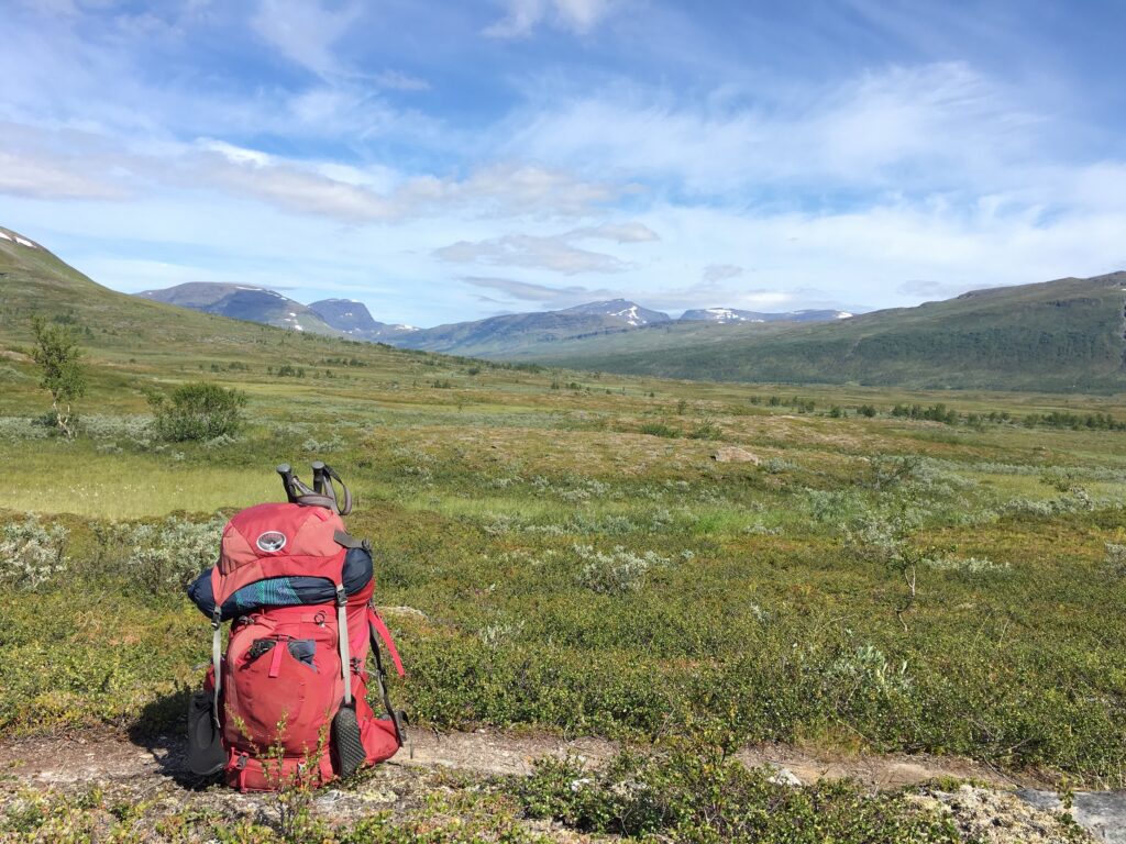
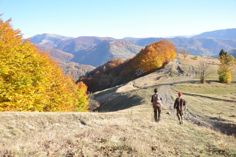
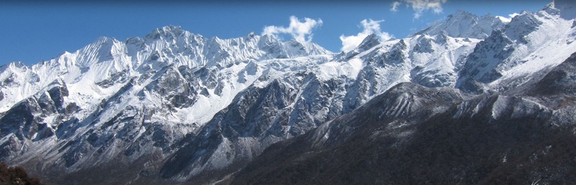
Stubai, het veelzijdigste bergdal van Oostenrijk?
Lees meer
NOORWEGEN, VAN TEEN TOT KRUIN
Lees meer
Op reis door Oekraïne - ooit kan het weer!
Lees meer
Een trekking door de Himalaya
Lees meer
Ontdek ons
ruime aanbod!
Populaire regio’s
Europa
Afrika
Azië
Noord-Amerika
Midden-Amerika (met Mexico), Caribisch Gebied
Australië, Nieuw Zeeland, Zuid-Pacifische Oceaan
Populaire bestemmingen
Nederland
Frankrijk
Duitsland
België & Luxemburg
Spanje
Italië
Turkije
Oostenrijk
Griekenland
Populaire categorieën
Kaarten en gidsen
Reisgidsen
Wandelkaarten
Fietskaarten
Fietsgidsen
Campinggidsen
Hotelgidsen
Restaurantgidsen
Wandkaarten
Wandelgidsen
Populaire productgroepen
Fietskaarten Nederland
Landkaarten Nederland
Wandelkaarten Nederland
Campinggidsen Frankrijk
Reisgidsen Frankrijk
Restaurantgidsen Frankrijk
Landkaarten Europa
De Noorderzon
Klantenservice
Over ons
Blog
Contact
We gebruiken cookies om ervoor te zorgen dat onze website zo soepel mogelijk draait. Als je doorgaat met het gebruiken van de website, gaan we er vanuit dat je ermee instemt.
Ok
Meldingen
Close menu
 Wandelgids