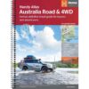
Australia Road & 4WD handy atlas
with camping areas, roadhouses and 4WD tracks


€29,95
direct leverbaar!
- Zeer ruim assortiment
- Verzending 1-2 werkdagen
- Niet tevreden, geld terug
- Ruilen binnen 14 dagen
Uitgebreide en gedetailleerde wegenatlas van Australië (hoe toeristischer en/of drukker het gebied, des te gedetailleerder de schaal). Spiraalband. Kaarten zijn erg helder en prima te lezen. Formaat is 23 x 17 cm. Met extra info m.b.t. zaken als kampeerplekken en Nationale Parken.
Featuring trusted Hema mapping for all of Australia, the Hema Road & 4WD Handy Atlas is the definitive travel guide for tourers and adventurers. Hema atlases feature more information useful to travellers, including 4WD tracks, campsites, caravan parks, rest areas, 24-hour fuel and points of interest. The new edition contains more mapping than ever before, which is enhanced by a striking new cartographic style that’s incredibly easy to read. Included in this is up-to-date mapping for Australia’s biggest 4WD destinations: Cape York, Fraser Island, the Top End, the Kimberley, the Pilbara, Central Australia, High Country Victoria and the Flinders Ranges. A handy distance grid, national park guide, list of accredited information centres and a complete index are also included to assist with trip planning and navigation, making it the perfect tool for guiding tourers, campers, road trippers and off-roaders throughout Australia.


-
 Kimberley | atlas & outdoor guideGedetailleerde wegenatlas over dit gebied, in spiraalband. De schalen variëren. Grootte: A4. | Thisdirect leverbaar!€46,00 > alles van Australië, Nieuw Zeeland, Zuid-Pacifische Oceaan
 -
 South Australia 1:1.800.000Great for use in the car, Hema's State Handy Maps clearly show highways, minor and secondary roads,direct leverbaar!€15,90 > alles van Australië, Nieuw Zeeland, Zuid-Pacifische Oceaan
 -
 Camps Australia WideThis spiralbound hardcover Camps Australia Wide includes the complete HEMA Road Atlas, with the campdirect leverbaar!€82,50 > alles van Australië, Nieuw Zeeland, Zuid-Pacifische Oceaan
 -
 Lonely Planet West Coast AustraliaGoede gidsen voor trekkers. Na info over land en volk, en reisvoorbereidingen volgen beschrijvingendirect leverbaar!€25,95 > alles van Australië, Nieuw Zeeland, Zuid-Pacifische Oceaan
 -
 Het Grote Rif | Helen ScalesIn de wateren tussen Australië en de Grote Oceaan groeit een beroemd rif. Vissen zwemmen tussen dedirect leverbaar!€18,95 > alles van Australië, Nieuw Zeeland, Zuid-Pacifische Oceaan
 -
 Cape York 1:1.000.000Featuring the Old Telegraph TrackThis brand new edition of Hema's best-selling Cape York map, on durdirect leverbaar!€17,95 > alles van Australië, Nieuw Zeeland, Zuid-Pacifische Oceaan
 -
 De Fatale Kust | Robert HughesDe fatale kust is de fascinerende geschiedenis van de geboorte van Australie. Het is het epos van daniet direct leverbaar€49,90 > alles van Australië, Nieuw Zeeland, Zuid-Pacifische Oceaan
 -
 Australie | wegenkaart - overzichtskaart 1:4.500.000Deel uit een serie overzichts-/ wegenkaartenkaarten, met een mooie en betrouwbare cartografie. Aanddirect leverbaar!€11,50 > alles van Australië, Nieuw Zeeland, Zuid-Pacifische Oceaan
 -
 Mid West, Western Australia 1:1,250.000Another beautiful map publication showing enormous detail. The map shows all major and minor roads adirect leverbaar!€15,95 > alles van Australië, Nieuw Zeeland, Zuid-Pacifische Oceaan
 -
 ITM wegenkaart / overzichtskaart Queensland 1:900.000A double-sided sheet with only small portions of adjoining states showing. The map also includes a ldirect leverbaar!€13,95 > alles van Australië, Nieuw Zeeland, Zuid-Pacifische Oceaan
 -
 Sydney, stadsplattegrond plus omgevingskaartHema's major city maps clearly highlight all freeways and major and minor roads. A complete overviewdirect leverbaar!€14,95 > alles van Australië, Nieuw Zeeland, Zuid-Pacifische Oceaan
 -
 Birds of Australia | vogelgids AustraliëAustralia is home to a spectacular diversity of birdlife, from parrots and penguins to emus and vibrdirect leverbaar!€39,95 > alles van Australië, Nieuw Zeeland, Zuid-Pacifische Oceaan