Kaarten en gidsen > Wandelen > Wandelkaarten > Europa > Britse Eilanden > Groot-Brittannië > Engeland > Noordwest-Engeland > Yorkshire Dales | wandelkaart 1:40.000
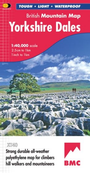
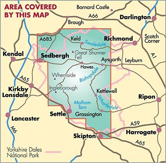
Yorkshire Dales | wandelkaart 1:40.000
€28,90
direct leverbaar!
- Zeer ruim assortiment
- Verzending 1-2 werkdagen
- Niet tevreden, geld terug
- Ruilen binnen 14 dagen
Titelinformatie
British Mountain Maps are published by Harvey Maps in conjunction with the BMC, and are designed especially for climbers, hill walkers and mountaineers.
The 1:40,000 scale maps use contour colour shading for easy identification of hills and valleys, and are printed on polyethylene, making them lightweight, tear-resistant and waterproof. The reverse side of each map contains mountain incident and first aid advice, navigation tips, useful visitor information, and geological information provided by the British Geological Survey.
- Printed on polyethylene - durable, tear-proof and 100% waterproof
- Made in cooperation with the British Mountaineering Council
- Colour shading for easy identification of hills and valleys
- Detailed crag information for climbers
- Less than half the weight of a laminated map
- Geological map of the Yorkshire Dales specially designed by the British Geological Survey
- Mountain incident and first aid advice
- Tips on using your map and compass
- Useful local phone numbers and websites
Titelspecificaties
| Regio | Noordwest-Engeland |
|---|---|
| Uitgavedatum | 2022 |
| Uitgever | |
| ISBN | 9781851376551 |
| Categorie | Wandelkaarten |

