Offa's Dyke Map | wandelkaart 1:40.000
scheur- en watervaste wandelkaart


€27,95
direct leverbaar!
- Zeer ruim assortiment
- Verzending 1-2 werkdagen
- Niet tevreden, geld terug
- Ruilen binnen 14 dagen
Titelinformatie
Waterproof walking map of Offa's Dyke Path at 1:40,000 from Harvey, with the route divided into individual panels so that you can have the entire trail on one easy-to-read sheet. Cartography shows public bridleways and footpaths, with permissive (permission may be withdrawn) paths indicated. The route is prominently highlighted, with parts on and off road differentiated; dual carriageways, A and B roads, including forest roads, are shown. Railway lines and stops are also marked.Topography is indicated by contour lines at 15m intervals, index contours at 75m intervals, and spot heights; there are numerous symbols to show varying terrain types. The map is GPS compatible, with the National Grid overprinted on each panel.Points of interest and local facilities such as food shops, information points, accommodation, and parking, are clearly marked. The map also has general information on public transport, safety for walkers, accommodation, useful telephone numbers, and more
Titelspecificaties
| Regio | Wales |
|---|---|
| Uitgever | |
| ISBN | 9781851376193 |
| Categorie | Meerdaagse wandelroutes, Wandelkaarten |
-
 wandelgids Snowdonia, Great Mountain Days inPrachtig geïllustreerd boek met beschrijvingen van vele wandelmogelijkheden in de hoogste bergen vadirect leverbaar!€24,95 > alles van Europa
 -
 Take the slow road Engeland en WalesOntdek op je gemak unieke routes door Engeland en Wales met de camper of autoSnel rijden? Echt niet!direct leverbaar!€29,95 > alles van Europa
 -
 Beacons Way | wandelkaart 1:40:000The Beacons Way traverses across the full length of Bannau Brycheiniog National Park. Established indirect leverbaar!€25,95 > alles van Europa
 -
 Offa's Dyke Path, Walking the | wandelgidsA handy guidebook for anyone walking the Offas Dyke National Trail Path. The 170 mile long-distancedirect leverbaar!€23,95 > alles van Europa
 -
![EXP-012 Brecon Beacons / Western [OL12] | wandelkaart 1:25.000 9780319242513 Ordnance Survey Explorer Maps 1:25t. Wandelkaarten Zuid-Wales, Pembrokeshire, Brecon Beacons](https://www.denoorderzon.nl/wp-content/uploads/2019/05/9780319242513.jpg "EXP-012 Brecon Beacons / Western [OL12] | wandelkaart 1:25.000 9780319242513 Ordnance Survey Explorer Maps 1:25t. Wandelkaarten Zuid-Wales, Pembrokeshire, Brecon Beacons") EXP-012 Brecon Beacons / Western [OL12] | wandelkaart 1:25.000Deel uit een serie zeer gedetailleerde topografische wandelkaarten (1:25.000), perfect om mee te wandirect leverbaar!€19,95 > alles van Europa
EXP-012 Brecon Beacons / Western [OL12] | wandelkaart 1:25.000Deel uit een serie zeer gedetailleerde topografische wandelkaarten (1:25.000), perfect om mee te wandirect leverbaar!€19,95 > alles van Europa -
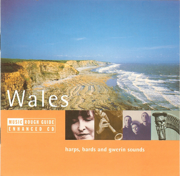 WalesIf you want to explore the music of another country you need a guide... Like the useful Rough Guidedirect leverbaar!€14,95 > alles van Europa
 -
 EXP-214 Llanidloes / Newtown / Y Drenewydd | wandelkaart 1:25.000Deel uit een serie zeer gedetailleerde topografische kaarten (1:25.000), perfect om mee te wandelen.niet direct leverbaar€19,95 > alles van Europa
 -
 Grensland | Raymond WilliamsToen Gerbrand Bakker De omweg schreef, ontdekte hij in een boekwinkel in Wales Border Country van Radirect leverbaar!€25,95 > alles van Europa
 -
 Experience Wales | Lonely PlanetExperience Indigenous culture, explore unforgettable cities and immerse yourself in spectacular natudirect leverbaar!€26,95 > alles van Europa
 -
 LR-170 Vale of Glamorgan | topografische wandelkaartKLIK OP DE SERIENAAM, DAN VERSCHIJNEN ALLE KAARTEN OP VOLGORDE | Deel uit de serie topografische kaaniet direct leverbaar€19,90 > alles van Europa
 -
 Coastal Pub Walks: South WalesThis pocket-sized guide gives walkers ten easy, circular walks to amazing pubs along the South Walesdirect leverbaar!€10,95 > alles van Europa
 -
EXP-253 Lleyn Peninsula West | wandelkaart 1:25.000Deel uit een serie zeer gedetailleerde topografische kaarten (1:25.000), perfect om mee te wandelen.niet direct leverbaar€19,95 > alles van Europa