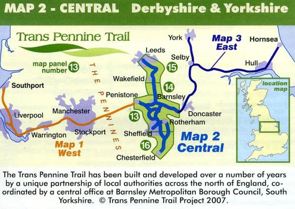
Kaarten en gidsen > Wandelen > Wandelkaarten > Europa > Britse Eilanden > Groot-Brittannië > Engeland > Noordwest-Engeland > Map 2: Central Derbyshire and Yorkshire *
€5,00
direct leverbaar!
- Zeer ruim assortiment
- Verzending 1-2 werkdagen
- Niet tevreden, geld terug
- Ruilen binnen 14 dagen
Titelspecificaties
2010 | Trans Pennine Trail Project
| 9780953227785
| Leeds to Chesterfield and Penistone to Sprotbrough
Extra titelinformatie
This map covers the Central area of the Trans Pennine Trail including the north-south section of the Trail between the lively city of Leeds and the Derbyshire market town of Chesterfield. This also shows a portion of the east-west route from Penistone to the village of Sprotbrough near Doncaster.The central section covers a whole network of routes, linking the major urban centres of the region including Sheffield, Rotherham, Wakefield, Chesterfield, and Barnsley. The map shows a walking, cycling, and in places, horse riding route. This section of the route covers an amazing range of sights and scenes as the Trail passes through countryside, towns and cities of the North of England, on historic railways, packhorse routes and canals, riverside paths and woodland bridleways. Distance: Leeds to Chesterfield 70 miles. Penistone to Sprotbrough 21 miles. Much of the Trail is traffic-free. Map 1:50,000.
Andere producten uit dezelfde regio

